
Before I go much farther, I need to mention that “Mo” is Sharon O Sligar. That nickname has been around for almost 20 years, bestowed on her by my sister for some complex reasons. The name stuck, mostly because Mo likes it. She said the other day to someone who asked, “Yes, my given name is Sharon, but many friends know me as Mo. I like that nickname”.

With our southern desert sojourn postponed indefinitely, I asked Mo what she might want to do for her birthday. Dinner out? Oops…maybe not yet. A cake? Nah, she isn’t particularly a cake lover. Maybe a pie.
Yesterday afternoon she presented me with a plan. She has “A Guidebook to Places of Special Interest: Southern Oregon and Northern California”, published by the Medford Mail Tribune way back in 1992. Reviewing some of the local interesting spots we might have missed, she decided that a round trip drive to the 5 covered bridges in Josephine and Jackson counties was what she wanted to do to celebrate her day.
We have visited 4 of these 5 bridges in the past, and both of us thought that it would be fun to follow the back roads listed in the guidebook and photograph all the bridges on the same day. Some of you may remember our covered bridge trip in other parts of Oregon that we did in 2012. On that camping adventure we spent several days driving to more than 40 bridges, but we didn’t visit the bridges in our own local area.

Springtime is close here at Sunset House, but the mornings are still frosty and often foggy. No worries, however, with predictions for a sunny day ahead it was perfect weather for a drive. Following the directions in Mo’s book, I mapped out a somewhat reasonable route for us to get to all 5 bridges in a day. It was basically a big circle with a couple of extended arms.

After perusing the route and checking timing for traveling in a clockwise or counterclockwise direction, we decided to visit the Grave Creek Bridge early in the day. We have seen this bridge before, on a sunny morning in early March in 2018. I never blogged our visit, but we both remember it well for the sweet man working on the bridge who told us many stories about the local area. He especially loved working on the covered bridges.

Here is the photo I finally found from our visit in 2018
Here is a bit of a funny story about the photos of that day. I somehow lost them. Not on my computer, not in Google Photos, not in Lightroom or uploaded to my extensive galleries on SmugMug. I couldn’t figure it out. Finally, I searched our calendar and came up with the day of our visit, and searching my Facebook uploads I found 5 photos of that morning. I had tons of photos both before and after in my galleries online and on the computer. For once, the facebook uploads saved a memory that might have been lost if I hadn’t posted it. Rather amazing. Although the process took an entire hour out of my blog writing time this morning!

The Grave Creek Bridge is in Sunny Valley, about 15 miles north of Grants Pass, and can be seen from Interstate 5. It has six gothic style windows on either side, concrete abutments, a Howe truss, rounded portals and a shake roof. It is quite a lovely bridge, with views of the creek below. The old wooden river crossing is the last covered bridge on the north-south Pacific Highway system. It was built in 1920 in just four months. When Interstate 5 was built nearby, ownership and maintenance of the Sunny Valley Loop Road, which includes Grave Creek Bridge, passed to Josephine County. In the late 1990s, the bridge was closed to traffic and was reopened in 2001 after repairs to the approaches and housing.

In 1846 the first emigrant train from Fort Hall, Idaho, to travel the southern route to the Willamette Valley camped on the north side of this creek, then Woodpile Creek. Martha Leland Crowley, 16 years old died of typhoid fever during this encampment and was buried 150 feet north of the creek on the east side of a white oak tree that was later removed for the present roadway, Thus the name "Grave Creek".
The nearby Applegate Trail Interpretive Center provides a first hand look into the local area, history, fabulous displays, theatre & more. Sadly it was closed both times that we visited the bridge. There are many local museums that are closed due to COVID. Someday we may have to return and visit.
 The design is “Covered Howe through truss”. After our previous covered bridge explorations, we enjoy paying attention to the different types of construction and trusses.
Length of largest span: 105.0 ft. Total length: 220.2 ft. Deck width: 18.4 ft. Vertical clearance above deck: 15.0 ft.
The design is “Covered Howe through truss”. After our previous covered bridge explorations, we enjoy paying attention to the different types of construction and trusses.
Length of largest span: 105.0 ft. Total length: 220.2 ft. Deck width: 18.4 ft. Vertical clearance above deck: 15.0 ft.
 We parked on the south side of the bridge, and I walked through taking a photo of Mo driving through in the car. We then parked on the north side of the bridge, trying to figure out where the buildings from the old town site shown on the information panels were located. Seems as though they are all now gone, with nothing but open fields and a few newer houses to mark what was once the small village of Fort Leland.

Returning to the interstate, we drove south over Sexton Pass toward Grants Pass and on to Rogue River. Even though the skies were clear, at the approximately 1900 foot elevation at the summit, we saw a lot of smoke throughout the valley where Grants Pass sits along the Rogue River. It seems that sunny clear days are often burn days this time of year, and burning is a very popular option for rural folks.
As long as we have lived in this area, we have never traveled the road north from Rogue River along Evans Creek toward the tiny hamlet of Wimer. It was surprising to discover this rural broad valley that is just over the ridge from I-5 and our Valley of the Rogue.

When we arrived at the bridge, we drove through the bridge to the north side where it seems that everyone living in that area congregated. The little store and gas station were both busy, and with 5 roads coming to the intersection at the bridge. It seemed as though most everyone knew each other, hollering “hi”from their trucks. We were definitely the outsiders. Parking was limited but we took a spot in a wide place across from the store to explore the bridge. It was a bit scary to walk back across the bridge to the park. This bridge has no pedestrian pathway.

The Wimer Bridge was saved from destruction when local residents battled to initiate a rebuilding of the weakened structure in 1962. Community members insist that the original bridge was built in 1892, and a sign posted on the bridge claims title to that date. The Hartman brothers, bridge builders of Jacksonville, replaced the Wimer Bridge in 1927.
I didn’t learn that the Winer bridge had collapsed in 2003 until I began writing this blog! The following is from a website about the bridge:
“On a hot summer afternoon, in the quiet community of Wimer, Oregon, local residents were startled to hear a giant crashing sound coming from the vicinity of their covered bridge. Customers at the Wimer Market, only a dozen paces away, rushed out to witness the unthinkable. The historic Wimer Covered Bridge in Southern Oregon had spontaneously collapsed into Evans Creek. Those who were the closest also heard shouts for help coming from inside the rubble and scampered down the bank, over the shattered shingled roof and lifted broken wooden beams to rescue a man and his two young grandsons. They were the last persons to stroll through the old covered bridge on that fateful Sunday.
The July 6, 2003 incident shocked and saddened a community. The weekly Rogue River Press expressed what many residents felt with the simple headline in its next issue: “It’s Gone!”
Ironically, the covered bridge was scheduled for a major overhaul. Engineers had completed blue prints just two months earlier and the construction project was to go out for bid in September that year. Jackson County had acquired grants for over a half million dollars for the renovation that was due to begin in 2004. But the tired old structure couldn’t wait and gave way in mid stream. Obviously, there has been a change in plans.”

Originally Built 1892, Rebuilt 1927, Rebuilt 1962, Collapsed 2003, Rebuilt 2008 with “covered through trusses”. Length of largest span: 86.0 ft., Total length: 170.9 ft., Deck width: 17.1 ft., Vertical clearance 10.1 ft.

We walked back through the bridge to the tiny park on the south side along Evans Creek. Mattie had a chance to run around a bit and we found a very sketchy restroom that served well enough in an emergency.

Our next bridge on the loop was a considerable distance south and east in the town of Eagle Point. We have been to Eagle Point by way of Sams Valley many times. However, we had never followed the narrow back mountain road along East Evans Creek through the Sams Valley.

The road was narrow and twisty in some places, with larger ranches scattered throughout the landscape and many large “grows” visible along the narrow valley adjacent to the creek. It was a pretty drive, and we were especially glad that we made the decision to do this part of the tour in the early part of the day rather than later in the afternoon ad would have been the case if we had chosen a counter clockwise route.
Crossing Dodge Bridge at the Rogue River we thought about having a picnic, but the fee to enter seemed silly and there were dogs and people around the few picnic tables. Instead, we continued toward Eagle Point and the third bridge of the day.

The Antelope Creek Bridge is sometimes called the Butte Creek Bridge, and is just a block or so south of the beautiful old Butte Creek Mill which burned on Christmas morning in 2015. People are continuing to make donations toward restoration of the old mill, but even after all these years, the site smelled like fire.

We parked near the bridge, across the street from a charming little town square and a big bright mural on a well lit southern facing wall with no parking in front of it. Mural photographers will know just how hard it is to find conditions like this when trying to photograph murals.

The Antelope Creek Bridge originally spanned Antelope Creek some 10 miles southeast of Eagle Point. In August 1987, the structure was loaded onto a makeshift trailer and volunteers hauled it to the city of Eagle Point. When the bridge was rebuilt at the new site, arched openings were cut into each side so school children could be watched as they crossed the span. This alteration caused the bridge to be removed from the National Register of Historic Places. Since then, the bridge has been re-sided in a fashion that represents the original design. Now only ribbon openings appear under the eves.
Construction is with Queenpost through trusses over Little Butte Creek on the Pedestrian Path in Eagle Point. Length of the largest span is 58.0 ft.

After visiting the bridge we decided we really wanted a place to rest a bit and enjoy our picnic lunch. Driving through town, we discovered a fairly new city park, Lucas Park. The bathrooms were new and spotless, with picnic tables scattered around the large grassy play area. There were several families with young children playing on the kid toys and we watched a young woman with a baby in a stroller completing many laps of what looked to be a quarter mile paved pathway.

We sat for some time in the sun enjoying our lunch and watching people playing and visiting. It felt like normal life pre COVID. It was outdoors, and no one had on a mask. I felt like I was in some kind of twilight zone!. Little kids were roller blading and scootering around the path and moms were putting kids in and out of strollers and laughing with their friends.
The next bridge on our tour required us to travel east on Highway 140, the familiar route we would take when returning from Medford to our prior home in Rocky Point. The Lake Creek district is visible from the highway and the Lost Creek Bridge is several miles toward the mountains along Lake Creek and Lost Creek. It is a lovely area of ranches with some historic buildings in what was once a small community.

Note that the little dog at our feet is NOT Mattie. We had to leave Mattie in the car when two farm dogs came running toward us when we parked. This little girl was insistent that she be a part of our photo.
We have visited Lost Creek Bridge in the past as well, and once again, I cannot find any photographic record of the visit. I even remember taking photos of the old buildings and of daffodils by the bridge, so surely it was in the springtime.

The Lost Creek Bridge, at only 39 feet long, is the shortest of all Oregon covered bridges. Since 1979, the structure has been closed to traffic.
Many Jackson County residents, including Shirley Stone, daughter of pioneer John Walch, claim the Lost Creek Bridge to have been built as early as 1878-1881. If authenticated, this would make it Oregon's oldest standing covered bridge. Johnny Miller, the builder of the Lost Creek Bridge, also roofed the nearby span at Lake Creek in the 1880s, thus lending credence to a sign nailed on the bridge: LOST CREEK BRIDGE, BUILT ABOUT 1881. The span may have been partially or totally rebuilt in 1919, hence the official construction date in that year.

Features of the bridge include the usual county Queenpost truss design, a shingle roof and flying buttress braces. The rough wooden flooring consists of diagonal planking, and hand hewn truss members provide structural stability. A new roof was installed by local residents in 1985. Portal boards were added in 1986, restoring the look of the span in 1920 before accommodations were made for log truck traffic.

The Walch Memorial Wayside Park abuts the bridge site. Descendants of John and Marie Newsome Walch built and maintain the park, which includes picnic tables, a bandstand, cooking areas, an early 1900s outhouse, and manicured flower gardens.
The bridge was nearly lost in the 1964 Christmas flood. As swirling waters and heavy debris lashed at its piers,residents and concerned bridge enthusiasts prayed during the night that the bridge would be saved. According to a local newspaper, the skies opened and the water receded as morning came. The journalist questioned, "Was the bridge saved by prayer?"
 The final bridge we wanted to see was in the southern part of Jackson County. Our route required traveling more than 50 miles through Central Point, the outskirts of Medford, the town of Jacksonville and the community of Ruch toward the Applegate. Nothing new along the way for us as we have traveled these routes for years. We thought maybe we could stop for an early supper in Jacksonville where inside dining was supposedly allowed this week. However, it was only 3:30 when we reached Jacksonville and we were still full from our late lunch.
Instead we continued south along the Applegate River toward the McKee Bridge. I do have photos of our visit to this bridge back in 2011, when we made a day trip from Rocky Point for a picnic. Abby was with us on that day and one of the photos I took of her is still a favorite.


In 1956, the bridge was declared unsafe for vehicular traffic. The combined efforts, in 1965, of the Talisman Lodge, Knights of Pythias, Upper Applegate Grange, and the Jackson County Court restored the roof, thereby keeping the aging structure open for pedestrian use. Little upkeep followed, and by the early 1980s County officials were worried about the strength of the bridge. During the summer of 1985, more than $40,000 in labor and materials were dedicated to repair the bridge and keep it open for pedestrians. Jackson County officials then announced that future County investment in the bridge would be impractical, and has looked to private efforts for ongoing preservation of the McKee span.
The McKee Committee was formed in January 1989 with the goal of raising $25,000 for preservation and maintenance of the span. By mid summer, a major portion of the funds, or volunteer labor, had been generated. Included in the final fund-raising was the sale of memorabilia and the production of an historic quilt featuring a bridge motif.

Features of the Mckee Bridge include a Howe truss design, flying buttresses, open daylighting windows at the roofline, and a shingle roof. Lindsay Applegate, for whom the stream is named, prospected the area on the way to the mines in California. The discovery of prosperous mines caused a north-south route to be developed in the area, and the covered bridge was used as a rest stop, until 1919, because it was halfway between Jacksonville and the Blue Ledge Cooper Mine to the south. Length of the largest span is 122 feet.

The picnic area next to the bridge is quite lovely, with a large gazebo with picnic tables and a big fireplace. Surprisingly there is an old upright piano in the gazebo and I had to give it a try. Neither Mo nor I could figure out how a piano could be left outdoors in the heat and humidity and winter cold without getting completely ruined. When I played it a bit, I understood. The sound was tinny and terribly out of tune, so much so that Mattie averted her head when I started playing.

By the time we left the park and began the long journey back home through the Applegate Valley, we were both fairly worn out. I was glad Mo was driving. There was no birthday dinner and no birthday cake or pie waiting when we got home. Instead we got out the fixings for tacos that we enjoyed the evening before and had a perfectly delicious meal, right at home, ready in about 5 minutes from fridge to table.
Mo said she didn’t mind in the least and that her birthday had been especially satisfying.


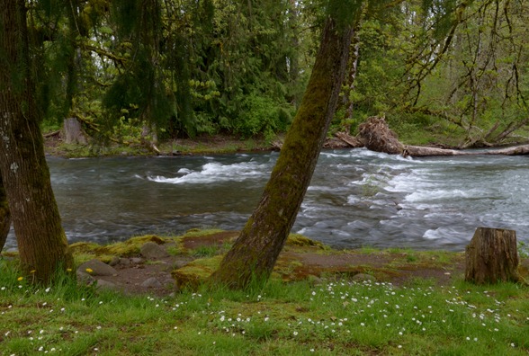 Instead, we drove all the way with both rigs, and thankfully there was parking on the far side of the Larwood Bridge at the most lovely little park I have seen in a long time. We stayed there a long time, enjoying the river, the park, and the beautiful setting of this lovely open bridge.


 With a long afternoon ahead, we decided to travel west to the little town of Wren and the

 We then found the forest road that led to the


