Current location: Corpus Christi NAS with 53 degrees F and 18 mph winds at 4am
 I am sitting here this morning, listening to the winds buffeting the MoHo. At 3, we were wakened by the gas alarm going off indicating our power was down. I stepped outside to check, and everything seemed fine, with dim park lights here and there. I discovered that the wind had blown the power cord right out of the receptacle. Fixed it with a bungie and came back to bed after turning the power back to “store”.
Of course, the moon is almost full and reflecting off the water of Corpus Christi Bay, a rather amazing sight. There are also 8 to 10 foot fountains of sea spray that are illuminated by the moonlight. I felt the spray blowing this way when I went outside. We were warned about the sea spray and winds when we took this site on the edge of the park near the water. It is worth it for the view and the open spaciousness of the site.
 Mo and I looked at each other in amazement as we ate our supper last night. It is rather incredible to go from the wild hot dry angular desert to the flat water filled landscape around us here west of Corpus Christi. Just one day of driving, and here we are.
But that isn’t supposed to be the subject of this post. I need to write about Big Bend, and let myself slip back from this moonlit sea spray filled morning to the warmth of the desert we left behind. I couldn’t sleep after the wind woke me up, and it was as much from the weight of the Big Bend writing waiting in my head as it was from the sound of the wind. So let’s slip back a bit to a few days ago when we first entered the amazing world of the Big Bend of the Rio Grande.
The sun was brilliant and the temperatures perfect when we left Davis Mountains State Park. In the cool of the morning, I wanted to get a few more photos of “downtown” Fort Davis, and in the process ran into a delightful gentleman, Jim, who was working for the county at the lovely courthouse, pruning some trees. We engaged in some conversation, and he told me more about the horrible fire that blew through here in 2011. He also told me that I shouldn’t go to Big Bend through Alpine as we had planned, but should go south on highway 67 to Presidio and travel the River Road east through Big Bend Ranch State Park.
 MBZ had warned us that Presidio was a bit dicey, and I asked Jim about this, and he said, just don’t go into Mexico and don’t stop anywhere. Ok then. Trouble is, once we got to Presidio, the phone thought I was in Mexico and decided to stop sending me data for the maps. I had a paper map, but it was a bit worthless for actually seeing the proper turns, and suddenly the big entry into Mexico loomed up ahead, and I hollered, “Turn around NOW!” For some reason, I had completely forgotten the Garmin tucked under the seat. Duh. When the phones don’t work and the paper maps are too small in scale, the Garmin is quite helpful. Trucker Deanna always says, “Mom, we use all three all the time, phones, paper maps and GPS”. Of course. We managed to avoid getting in the entry line and turned around to find our proper turn east on Texas Farm Road 170.
 Farm Road 170 meanders along the Rio Grande through another wild and untamed gem of this part of Texas, Big Bend Ranch State Park. We had no time to hang around here, but definitely enjoyed the dramatic views along the route, especially the deep canyons of the Rio Grande near the one rather serious “Big Hill”. The hill isn’t marked except for a sign about 15 miles west of it that says, “warning 15 percent grade 15 miles ahead”.
 Following the river for miles and miles, it is easy to see that the international boundary is often just a mental concept. Here there are no fences and we didn’t see much evidence of Border Patrol in this area. The road winds and meanders, but wasn’t difficult for our rig, although the big hill was just a little bit hair raising, and thankfully quite short. The rock formations at the Hoodoos were beautiful, and the geology was fascinating.
We drove east into the town of Terlingua, later wishing that we had taken more time to explore it a bit, but we were intent on getting to our campsite on the far side of the park. We missed a four star attraction listed in our guidebook, the historic Starlight Theater at Terlingua, restored as a restaurant. We won’t make the same mistake again. MBZ had warned us about this, suggesting that we spend time on BOTH sides of the park, and next time we will definitely do that. And yes, there WILL be a next time.
 Once we entered the park, the beautiful range of the Chisos Mountains dominated the landscape, but the route is mainly through the desert. Unlike the Sonoran deserts around Arizona, the Chihuahuan desert seems to have a lot more vegetation, with thick grasses between the prickly pear and creosote. The Chihuahuan Desert is the largest desert in the Americas, extending almost to Mexico City. Creosote and agave are the main indicator plants and there are several species of prickly pear and yucca. I saw not a sign of a saguaro, so common in the Sonoran Desert around Tucson. Most of the moisture comes as summer rains, with a bit more precipitation than in the Sonoran as well.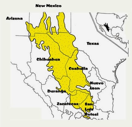
Panther Junction (at the intersection of the main park road 118 and road 395 east to Marathon) is about 20 miles west of Rio Grande Village, and is the location of an excellent visitor center. As always, we stopped at the visitor center for maps, orientation, and information about the park. There are some excellent displays, a good selection of natural history books and park guides to help us begin to understand this beautiful, remote area. My favorite, the 3D landscape map, was big and very helpful with orientation. I find that these maps are a bit less needed in the days of google earth, however, since I now can cruise an area in 3D on the internet and the imagery is a bit more detailed. Still, I love that the parks have these big map models.
 We arrived at our campground early enough in the afternoon that we had time to do a bit of exploring around this far eastern edge of the park. As we knew, there are no dogs allowed anywhere except on pavement or dirt roads that can accommodate a car. Still, it was hard to realize that we couldn’t leave Abby behind in the rig, or leave her in the car while we hiked. Just wouldn’t do. Instead, we planned our explorations around unpaved road trips and a few short hikes.
There are two campgrounds at Rio Grand Village, with the national park campground with campsites without hookups, potable water at the entrance and a dump station. There is a large no generator zone, and a nice area with sites big enough for large rigs and where generators are allowed at certain hours.
 Because we had no idea of the weather conditions for this trip, we opted instead for the Rio Grande Village RV park, basically a pavement parking lot with full hookups and WiFi from the small store and laundry. Gasoline and diesel are also available, and we were surprised at the reasonable cost for regular at only 3.65 per gallon. We have been in national parks where the prices are two bucks or more higher than the going local rate, so this was nice. We had no need to fill the rig since we had fueled up enough to take us through the park and back out, but we definitely needed gas for the baby car to fuel our off highway adventures.
Our first little trip took us just a few miles from the campground to Boquillas Canyon where there was a rest room at the parking lot and a sign marking the trailhead. It is just a little over a mile to the canyon, but the trail is “easy” if you ignore the rather steep and rocky ups and downs on the first part of the trail. I was glad for boots instead of Oofos, and those Keen Targha waterproof hiking shoes are a godsend. 
Mo generously decided to wait in the parking lot with Abby while I did the hike, a decision she made a few more times while we were in Big Bend. Next time we come to this place, if our animals are still with us, we will board them in Alpine, the closest center where there is a pet boarding facility.

The Boquillas Crossing used to be a port of entry from Mexico, but after 9/11 the DHS closed it, along with all other small ports of entry in the park. You can see the little town across the river, and at the river overlook we found displays of beaded trinkets with cans requesting $6. per item for little scorpions and for painted walking sticks. Wherever we found the signs, the request was for money to support Boquillas schools. We chose not to buy, and yet I did think about it, even though the park insists this is completely illegal and they will arrest you if you buy and confiscate your contraband.
Below us, across the river, there were boats tied up and some horses resting under the trees, and someone called up to me as we stood there but I couldn’t understand him. His voice sounded friendly, though, and I am sure he was entreating me to buy something.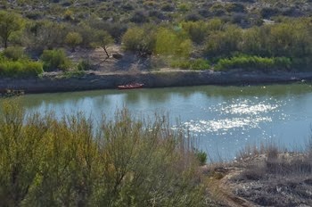
As I hiked up the trail, I found a few more of these little stashes, and at the entrance to the canyon, I saw a canoe hidden in the rocks on the Mexico side of the Rio Grande. Higher on the trail, looking down below to the river, I saw a man on a horse, and the trail, steep and rocky as it was, actually had horse prints and horse poop on it. Why do horses get to poop on trails and dogs are not even allowed to go there on a leash with a loyal pooper scooper in tow? I’ll bet anything that guy was from Mexico and had managed to cross the river somewhere to check his little can stashes.
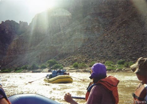
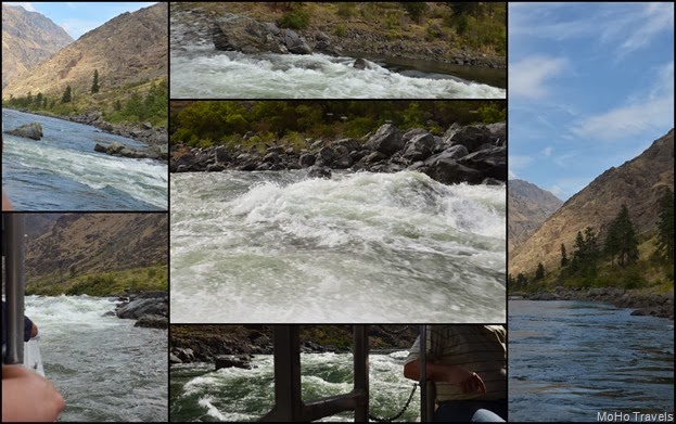
The entrance to Boquillas Canyon was dim, hard to photograph in the late afternoon light, but it was silent and beautiful, with walls rising more than 1,200 feet above me. I love tall, tight canyons, love how they feel, and found out later that this canyon is one on a list of possible river runs that I would love to do someday. Probably not in my own kayak, however, since there are some rocky rapids that need a good river guide to navigate. Still, it is on the bucket list along with Santa Elena Canyon. That is tomorrow’s story, however. 
When I got back to the car, Mo and Abby were contented enough, and we did figure out that we should have a book or two in the car for Mo while I wandered about. Mo and Abby go their exercise by doing six laps around the parking lot. One of the greatest little treasures that we found at the visitor center was a small book called “The Big Bend Guide” by Allan Kimball. We loved this little book, a great find for first time visitors, with down to earth explanations of the local routes, and what to do if you have only one day or three days or a week in the park. I highly recommend this book if you have never visited Big Bend.
 We drove back to the main road, and then again turned off on a dirt high clearance road to find the Hot Springs. The road is only about a mile and a half to the parking area, and we had hoped that maybe there wasn’t anyone around so we could possibly explore with Abby. Instead, this was a very popular spot and there were several cars parked and lots of folks heading to and from the springs.
The area was once a large hot springs resort, with a bath house, motel rooms, and even a store and post office. The abandoned buildings and old palms only hinted at what a delightful place this might have been at one time. The sun was down, and the evening was cool in the twilight, so Mo decided to leave Abby for a short time while we walked the short distance to the springs.
 The springs are 105 degrees F, in a small rock pool built along the Rio Grande, and look quite nice. However, when we arrived, they were filled with a couple of families, kids all happily playing and moms floating au naturel in the hot water. I really didn’t want to jump in with them, so I decided to wait for another time for a dip in the springs.
We ran into this multiple family again a couple of times, with Alaska plates on their RV. There were a LOT of people in that rig, but when we talked to them we found out that they were from Austin and had rented the RV. They were having great fun together, although a motorhome with 4 adults and 4 little kids might be a bit much. Whew!
 We were happy to get back to our rig and eat the good supper of leftovers from our previous dinner. So nice not to have to cook when it is dark and we have had a very long day! With no telephone, but at least enough Wi-Fi to get some mail, we settled in and read all the literature we had about what we might want to do on our next full day in the park.
Big Bend is an International Night Sky park, with a commitment to keeping things dark and unpolluted with light. There are lots of references to seeing the Milky Way here, but our moon was already too bright and while the stars were wonderful, that gorgeous view of the Milky Way eluded me. I even got up in the middle of the night to check out the sky. Maybe it was because the elevation at the Rio Grande is about 1,800 feet and perhaps those great Milky Way views are at the much higher Chisos Basin.
Still, even in our small parking lot camp, the skies were dark and the night was silent except for some low voiced owls here and there. Loved it.
Tomorrow we travel the Scenic Route and find the magnificent Santa Elena Canyon

 Ichetucknee Springs
 One afternoon we made the drive from Oleno to Ichetucknee to check out the area and go for a swim in the famous Ichetucknee Spring. It was hot and sunny, but with Mo’s knee still giving her trouble we decided to save our kayak day for later in the week. An interesting feature we noticed was a wonderful paved bike trail that passed Oleno State Park, through the tiny town of Fort White, and continued all the way to Ichetucknee Springs State Park. Made us wish we had brought the bikes on this trip after all.
 We found the headwaters of the spring, which was in a bit of turmoil due to construction and upgrades to the park infrastructure. It was just a short walk from parking to the spring area and the cool waters of the spring were a perfect antidote to a hot, somewhat muggy day. I managed to get over the first shock of the 72 degree water and within minutes was enjoying the rushing feel of swimming directly over the “boil”, the place where the crystal clear water emerges from the limestone cave below.
  After I had my fill of swimming, Mo relaxed by the spring while I hiked the half mile along the river to another famous spot on the Ichetucknee, The Blue Hole. This underwater cave is especially popular with divers, and sure enough, there were divers at the hole coming and going.
 The Blue Hole is much smaller than the main spring, and darker. I could barely see where the water emerged among all the dark green river grass.
  The Ichetucknee is a spring-fed, pristine river. Most of its 6 mile length are within the state park, but couple of miles are south of Highway 27 and there are houses on that portion of the river as is flows into the Santa Fe River. The water in the river is crystal-clear and is 72 °F (22 °C) year-round. There are nine named springs within the Ichetucknee Springs group with an average total flow of 212 million gallons per day. The group includes: Ichetucknee Springs, Cedar Head Spring, Blue Hole Spring, Roaring Springs, Singing Springs, Boiling Spring, Grassy Hole Springs, Mill Pond Spring, and Coffee Spring. The Ichetucknee is a tributary of the Santa Fe River, which in turn flows into the Suwannee River before emptying into the Gulf of Mexico.
 By Saturday Mo was ready to tackle sitting in the kayak for the length of the river. She wasn’t about to miss this beautiful water, and what we knew would be one of the best rivers in Florida. We followed the directions given to us by Laurel and Eric who say this is one of their most favorite rivers.
  We knew we had approximated 4 hours of kayaking ahead of us, and both agreed if Mo’s leg started acting up too much we could simply turn around. Happy to say that wasn’t needed and we kayaked as far as we could go to the headwaters and the official upriver launching site. We chose not to try to get in and out of the boats at that point, and simply turned around for the easy glide downstream.
 By leaving early in the morning, paddling upstream from the lower launch site, we had the river almost entirely to ourselves. Most people chose to launch at the headwaters and paddle downstream, and there are companies that will do a shuttle for a fee.
  The current was strong and the river was high according to some folks we talked to, but paddling upstream wasn’t difficult in the least. The warm day brought out the tubers and the paddleboarders as well, and even though tubing isn’t technically allowed on the river until after Memorial Day, we passed many folks lounging on tubes going downriver.
  The closer we got to the headspring, the more people we encountered, and when we turned around, we were among all those folks just idly sliding downstream thoroughly enjoying the crystal clear water, and the beautiful cypress forest.
 The best part of the paddle happened just a short time after we launched. In a calm wide spot on the river, only a few hundred yards from the launch site Mo saw three manatees swimming beneath her boat. It was a thrilling moment, and the big gentle creatures swam slowly around us and below us, ever so gently, rising every few minutes to take a breath of air.
 That soft whoosh of their breathing is such a sweet sound, and then watching them sink back gently to the river bottom to graze is somehow calming. I loved floating around with them, but we still had the entire river to kayak, so we left them to the grassy meal and continued on our way.
 The river flows almost entirely through cypress swampland, and when we started everything was a bit gray and dingy. As the sun filtered through the morning fog and clouds it illuminated the tiny cypress and maple leaves that were just starting to pop with spring color.
 It was a beautiful morning on the river, and took us just about 4 hours to paddle upstream and back down. Mo managed to get in and out of the boat without incident, and her knee was no worse for wear after the paddle than it would have been anyway. Which isn’t exactly good, but the river trip didn’t make it any worse, and we had a wonderful day.