Current Location: Lower Lehman Creek Campground GBNP sunny and 78F predicted high today
 I worked in the mountains of the west for a bazillion years. I lived in the mountains of the west for a bazillion years. Mountains and bears seem synonymous to me. Imagine my surprise when we arrived at Great Basin National Park and there are shabby tin garbage cans, and not a bear warning anywhere. There are no bears here! I couldn’t figure it out for the longest time. I came up with all sorts of reasons, maybe they were hunted out and the great deserts that lie between the mountain islands kept them from coming back.
 Well, the last bear was here about 30,000 years ago, and not only are there no bears in Great Basin National Park, there are no bears anywhere in the Great Basin! Looking at a map of black bear distribution in the US, even the historic range of the black bear leaves a giant conspicuous hole in the map of the US encompassing almost all of Nevada and all of the Great Basin.
 When our June calendar showed no plans for a camping trip, we knew something must be done. Where to go. June is often full of mosquitos in our local mountains, and our home place is so convenient to kayaking and hiking, but we wanted to be sure to get somewhere new. That is getting more and more difficult it seems.
 Great Basin National Park came to mind. We have traveled in the vicinity several times, looking up at the great mountains of the Snake Range and thinking, “We need to get there someday”. We came really close on our way home last March from our three month trip east, but storms and wind and snow convinced us to reroute south toward the Mojave instead of north into the wilds of Nevada.
 The trip to Great Basin NP requires commitment. It isn’t near anything or on the way to anywhere. We traveled a gorgeous route down 395 taking an easy day and spending our first night out at the Desert Rose RV Park in Fernley. It is a nice little Passport America park, clean and tidy, with “the best TV east of the Mississippi”. All that has changed, however, with the advent of Charter Cable requirements for individual receiver boxes for each site, and the owner said, Nope, no more TV here. We had our little satellite, but TV wasn’t high on the agenda for only one night, so we didn’t bother to set it up.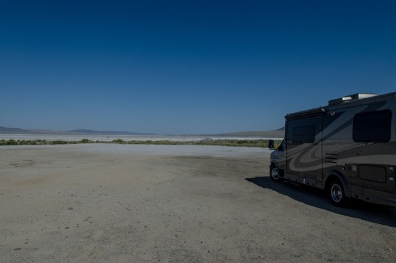
The next morning we headed west on Highway 50, and once beyond Fallon, the route lived up to its reputation as the “Loneliest Road in America”. That title was a bit more apt when it was first declared a few decades ago, but it still is one of the few places in the country where you can drive for miles without seeing another vehicle. Actually, the stretch between Alturas and Susanville on 395 was almost as empty of traffic. Daughter Deanna warned me when we left that school was out, vacationers were on the road, and traffic was completely crazy. Not in the world we have traveled this week. Lucky us.
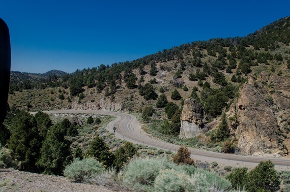 We decided to take the old Route 50 between White Rock Springs and Austin, a beautiful route with some serious curves and climbs but nothing too difficult, and again, no traffic.
By the time we reached the park, it was mid afternoon, early enough to hopefully find a campsite in the first come/first serve campgrounds. There are four listed campgrounds in the park, and another couple of locations for what they call “overflow camping”, with picnic tables and fire grills but no water. The camp at the lowest elevation, just a couple of miles from the Lehman Caves Visitor Center, is Lower Lehman Creek, with a few pull-through sites, water in the campground, and pit toilets. 
With most sites filled, we opted for the remaining pull through site #3, in spite of the fact that it was listed on the camp information sign as ‘extremely unlevel’. Most sites were listed as ‘unlevel’ except for the one accessible site at the entrance to the campground. No biggy, at least I thought so until I tried to sleep that first night with my head down from my feet in spite of all our work at leveling as much as possible.
We spent the first evening enjoying the sound of the creek, and I took a walk up the trail toward the Upper Lehman Creek campground to check things out. I got a serious reality check trying to hike up the steep trail at 7500 feet elevation. I have obviously been sitting around too much for the last couple of months. My lungs were aching after just a mile or so. sheesh! I am glad we gave ourselves a couple of days to acclimate to the elevation before trying the main park hikes that all start at the Wheeler Peak campground at about 10,000 feet elevation.
 The next morning we decided to seek out a lead on a young woman who might watch Abby for us while hiking, but as we were leaving, site 3 came open, and we nixed all plans and moved across the road to a lovely, almost level site right by the creek, with an open sky for the satellite. Perfect. With a bit of jockeying, I had the rig leveled, Mo had the solar panel out and the TV hooked up. We can run the inverter for the TV, satellite, and Direct TV box without taxing our batteries too much. Each day we do run the generator for a couple of hours to charge things up, but so far all is good.
Did I mention no bears? It just seems crazy to be in the mountains and not have to worry about critters getting into your stuff. There aren’t even raccoons or skunks around here either.
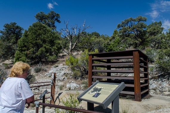 Once we settled into the new spot, we decided to go to the visitor centers. There are two of them for this park, the Lehman Caves center is within the park boundary, and the Great Basin visitor center is down in Baker. We wanted to tour Lehman Caves, and the tours do sell out, so getting tickets was first on our agenda. Later we found Rachel in the T and D Café in Baker, who agreed to watch Abby for us so we could do the tour together. Lucky find, if a bit expensive at $10. per hour. Rachel’s husband is the IT person for the park, and heard us at the visitor center asking about dog care in the vicinity. Rachel was a sweetheart and Abby enjoyed her two hour stay at her home with her two dogs.
 A slogan for Great Basin NP is that “half the park is after dark”. They have great night sky programs, and as one of the ten darkest night sky locations in the US, there is much to see. It would be great to be here during the dark of the moon, with views of the Milky Way that many of us only remember from childhood.
 Instead, we were here during the full moon, another perfect time, because the park has ranger guided full moon hikes each month during the season unless weather interferes. Free tickets for the hike are passed out only on the day of the full moon, beginning at 8 in the morning. The location of the hike is kept secret, and you are requested to bring your hiking shoes for inspection when signing up. In spite of the hard core rules about tough boots with ankle support, we saw several folks in tennis shoes, and Mo’s Keen sandals passed without a problem. We were afraid she might be denied a ticket at first, but it seems that the only real problem would be open toed sandals or flip flops.
 Both our Cave Tour and Full Moon hike were scheduled for Thursday, so we spent Wednesday exploring the area a bit in the Tracker. We explored the Baker Creek Road, and the other campgrounds in the vicinity of Pole Creek and the Grey Cliffs. The road was steep, graveled, but without a serious washboard problem at least, so in a pinch, we could have managed a campsite along Baker Creek at a few locations.
 By the time we visited the Great Basin Visitor Center, the sun was high and hot and Mo and I took turns going inside. As is usually the case, the visitor center was wonderful, with beautiful exhibits and I learned not only about Great Basin National Park, but the Great Basin in general. The term “Great Basin” was coined by one of my favorite guys, John C Fremont, the Pathfinder, back in the mid 1800’s. I’ll write more about that in my next post.
 We also traveled back through Baker and north to the Baker Archaeological Site. Although there isn’t a lot to see at the site, there are great interpretive signs explaining about the major dig here in the mid 90’s that discovered a complex community of what is now called the Fremont Culture, estimated to have been around 1300 AD. The best part about the site is the vastness of the view, and the gorgeous skyline in the west dominated by the Snake Range and Wheeler Peak.
 There are several dirt roads leading into the park, but the most traveled route is the paved Wheeler Peak Scenic Route that leads to the Summit Trailhead, and the trailheads for the Bristlecone Forest Hike, and several other high mountain hikes in that vicinity. The Wheeler Peak campground is gorgeous, but at 10,000 feet elevation, the weather up there was COLD. We saw folks in down coats and wool caps in the afternoon in their beautiful fir and aspen campsites. The campground was gorgeous, but the length limit for driving the road is 24 feet and we are 26. The level paved pads for camping were amazing, just too bad you can’t take a bigger rig up that road! Even so, it was nice to come back down the mountain to our warm campground.
Clouds were thick around Wheeler Peak on that first visit, but even with the cloud cover, the magnificence of the limestone mountains were evident. With more than 13 peaks over 11,000 feet high in the Snake Range that dominates most of the Great Basin National Park, there is no shortage of hiking opportunities for the hardy souls who can manage high elevation hiking. 
I do actually have a Verizon signal here at the campground, not always fast, but it is much better than the weak “out of area” signal that I get on my ATT iPhone. Between TV and occasional internet, we haven’t been too far out of touch while camping here. More to come in the next post but it is time to go explore Snake Creek and the Johnson Lake trail.


 Dropping down the grade toward Susanville on Highway 44
 Just under 400 miles in a day takes us closer to 8 hours in the MoHo rather than the google estimate


